
Grafling
Rohrmünz 31, 94539 Grafling, Deutschland
Hiking Parking Lot Rohrmünz | Photos & Hiking Trails
The hiking parking lot Rohrmünz is not a large excursion destination with much infrastructure, but rather a straightforward, very useful starting point for tours in the Graflinger Valley. That is precisely why many people are looking for photos, location information, and practical details: they want to know how the place feels, how to reach it, and which trails start there. Official documents from the municipality of Grafling and the district of Deggendorf list the parking lot at the address Rohrmünz 31, 94539 Grafling as a starting point in the Rusel-Oberbreitenau hiking center. From there, tours begin or run to Geißriegel, Loderhart, and Dreitannenriegel, in an area known for diverse forest and mountain hikes in the Bavarian Forest. ([landkreis-deggendorf.de](https://www.landkreis-deggendorf.de/media/35287/c-users-s1-gruberl-desktop-flyer_schneeschuh-und-winterwandern_rusel-oberbreitenau.pdf))
Anyone wishing to photograph the hiking parking lot Rohrmünz or plan an excursion should best understand it as a functional place: here, self-presentation is not the focus, but rather easy access to nature, forest paths, and peaks. The official character is also evident in the fact that the municipality of Grafling mentions the location on its hiking page and additionally offers a digitized hiking trail view for Rohrmünz. This makes the place particularly interesting for people who want to start a tour spontaneously on-site or are specifically looking for a starting point for circular and destination hikes. ([grafling.de](https://www.grafling.de/tourismus/wanderweg-3-rohrmuenz/))
Photos and Location at the Hiking Parking Lot Rohrmünz
When searching for photos of the hiking parking lot Rohrmünz, it usually revolves around two things: first, the question of how peaceful and close to nature the starting point appears, and second, what the surroundings offer visually for hikers. The official maps and trail descriptions show a location in the area of a mountain village and a designated hiking area, not in the middle of an urban zone. The flyer from the district of Deggendorf categorizes the parking lot under snowshoeing and winter hiking and names it as a starting point for tours to Geißriegel and Dreitannenriegel. This already makes it clear that the place is characterized by forests, mountain ridges, and typical Bavarian Forest landscapes. ([landkreis-deggendorf.de](https://www.landkreis-deggendorf.de/media/35287/c-users-s1-gruberl-desktop-flyer_schneeschuh-und-winterwandern_rusel-oberbreitenau.pdf))
The municipality of Grafling also describes the region around Rusel-Oberbreitenau as a hiking center with more than 400 kilometers of trails, mixed forests, open highlands, and moor landscapes. Rohrmünz lies in this environment as a starting point that is not spectacularly staged but embedded in a developed hiking landscape. For photos, this means: the charm of the place lies not in the parking lot itself, but in the transition from asphalt and forest road to forest, mountain path, and viewpoint. Those planning images will find typical motifs of a hiking start in the Bavarian Forest: signs, waymarkers, forest edges, the access road, the small hamlet character, and proximity to marked routes. ([grafling.de](https://www.grafling.de/media/39290/gemeindeblatt-2021.pdf?utm_source=openai))
Particularly interesting is the trail layout in the surroundings. The official hiking trail 3 of the municipality of Grafling leads from the village square initially uphill, crosses the federal road 11 via a pedestrian underpass, and then continues to ascend until it reaches Rohrmünz. Along the route, according to the trail description, a highest point of 748 meters is reached, and there is also a rest area with an overview map. This is important for photographers and planners because it not only provides a parking lot but also a whole small system of viewpoints and rest points. Even if the actual parking area remains simple, the scenic backdrop is clearly documented: mountain path, forest, valley view, and a small mountain village as a destination. ([grafling.de](https://www.grafling.de/media/24235/wanderweg_3_-rohrmuenz.pdf))
Access and Parking at Rohrmünz 31
The official address of the hiking parking lot is Rohrmünz 31, 94539 Grafling. This is the most important information for access, as search queries often inquire not only about the parking lot name but also about the exact address. The district of Deggendorf mentions the same address in its flyer for snowshoeing and winter hiking. This confirms that this point is not only locally known but also firmly anchored in regional hiking documents. For navigation, this double confirmation is helpful as it reduces the risk of ending up at a similar location in the vicinity. ([landkreis-deggendorf.de](https://www.landkreis-deggendorf.de/media/35287/c-users-s1-gruberl-desktop-flyer_schneeschuh-und-winterwandern_rusel-oberbreitenau.pdf))
No official parking capacity is mentioned in the available sources. This is not unusual for small hiking parking lots, as the focus is often on the function as an entry point into a network of paths rather than on formal parking documentation. Therefore, anyone needing particularly precise planning should pay attention to local signage and plan some buffer time for outings with higher attendance. The clear assignment is especially important: Rohrmünz is mentioned in official documents as a starting point for tours, and the municipality of Grafling explicitly recommends the hiking parking lots in Rohrmünz as ideal starting points in the Rusel-Oberbreitenau hiking center. ([grafling.de](https://www.grafling.de/media/39290/gemeindeblatt-2021.pdf?utm_source=openai))
It is also practical that the location is in a region where several hiking parking lots work together as starting points. The municipality mentions, in addition to Rohrmünz, Ruselhaus, Ruselabsatz, and Unterbreitenau as starting points for tours. This shows that Rohrmünz is part of a larger network and should not be viewed in isolation. Therefore, those arriving by car should use the parking lot precisely for what it is intended: as a start for a tour towards Geißriegel, Loderhart, or Dreitannenriegel, not as a mere stopping point without connection. ([grafling.de](https://www.grafling.de/media/39290/gemeindeblatt-2021.pdf?utm_source=openai))
Especially when planning, it is worthwhile to take a look at the different official representations. The municipality of Grafling offers the digital hiking trail page for Rohrmünz and explains how the path can be traced in BayernAtlas. The district, in turn, mentions the starting address for winter tours in its flyer. Together, a clear picture emerges: Rohrmünz 31 is the real, practical access point for hikers who want to use the area around the Deggendorf house mountains. For access, therefore, the question is less about a large parking system but rather about clear orientation at the address and on the hiking maps. ([grafling.de](https://www.grafling.de/tourismus/wanderweg-3-rohrmuenz/))
Hiking Trails to Geißriegel, Loderhart, and Dreitannenriegel
The strongest reason why the hiking parking lot Rohrmünz is searched so often is the tours that begin there. The district of Deggendorf mentions in the winter flyer a snowshoe tour of about seven kilometers around Geißriegel. The starting point is the parking lot Rohrmünz 31, 94539 Grafling; from there, the trail leads to Geißriegel at 1025 meters, further to Loderhart at 924 meters, and then back to Rohrmünz via Kreuzfelsen and Steinplatte. This is a very clear, well-readable tour description with several notable points that shows how versatile the surroundings of the parking lot are. ([landkreis-deggendorf.de](https://www.landkreis-deggendorf.de/media/35287/c-users-s1-gruberl-desktop-flyer_schneeschuh-und-winterwandern_rusel-oberbreitenau.pdf))
A shorter tour to Dreitannenriegel is also described in the flyer from the same starting point. It is set at about four kilometers and leads via the destination hiking trail 3 to Dreitannenriegel at 1092 meters and to Riegelsattel at 1030 meters; afterwards, a transition to the Oberbreitenau tour is even possible. Thus, Rohrmünz is not only the entry point for simple forest walks but also a starting point for more ambitious mountain hikers seeking more height and more destinations. The hiking parking lot thus fulfills the role of a compact but very well-connected access to the highlands between Grafling, Rusel, and Oberbreitenau. ([landkreis-deggendorf.de](https://www.landkreis-deggendorf.de/media/35287/c-users-s1-gruberl-desktop-flyer_schneeschuh-und-winterwandern_rusel-oberbreitenau.pdf))
The municipality of Grafling itself also confirms the significance of the place in the official hiking trail network. On the hiking page, hiking trail 3 - Grafling - Rohrmünz - Grafling is listed as part of the municipal trail network, and the PDF description states that the circular route is 10.2 kilometers long, with 362 meters of elevation gain and a walking time of 2.5 to 3 hours at an easy difficulty level. In this trail description, Rohrmünz appears as a mountain village with a place to stop. The trail leads over a forest road, trail forks, and gravel roads to the place before returning to Grafling. This connects the parking lot with a very concrete hiking experience: those heading to Rohrmünz are moving within a documented, marked, and well-described trail system. ([grafling.de](https://www.grafling.de/tourismus/wandern/))
For seekers, these details are important because they show that the name Rohrmünz is used not only as a district but also as a hiking junction. The destinations Geißriegel, Loderhart, Kreuzfelsen, Steinplatte, and Dreitannenriegel repeatedly appear in the official documents and form a kind of core area for hikes starting from the parking lot. Therefore, anyone searching for images, tours, or trail descriptions should always consider Rohrmünz together with these destination points. This is precisely where the SEO relevance of the place lies: the actual benefit arises from the combination of parking lot, mountain range, and marked trail network. ([landkreis-deggendorf.de](https://www.landkreis-deggendorf.de/media/35287/c-users-s1-gruberl-desktop-flyer_schneeschuh-und-winterwandern_rusel-oberbreitenau.pdf))
Hiking Center Rusel-Oberbreitenau and Hiking Trail 3
Official municipal texts classify the hiking parking lot Rohrmünz within the hiking center Rusel-Oberbreitenau. There, visitors can expect, according to the municipality, more than 400 kilometers of trails, mixed forests, open highlands, and moor landscapes. This description is important because it explains the character of the entire area: Rohrmünz is not just a parking lot on the edge but part of a large, geographically diverse hiking area. This is particularly attractive for people looking for a new excursion destination, as different tour lengths and difficulty levels can be chosen from the same starting point. ([grafling.de](https://www.grafling.de/media/39290/gemeindeblatt-2021.pdf?utm_source=openai))
The hiking trail 3 of the municipality of Grafling illustrates this structure particularly well. The PDF description shows that the trail leads from the center of Grafling via Bahnhofstraße, a pedestrian underpass under the B11, and later via Rohrmünzer Weg towards Arztinger Berg. Along the way, there is a view of the opposite valley side, and after about 2.7 kilometers, the highest point of 748 meters is reached. After that, there is a rest area with an overview map before the trail reaches the mountain village of Rohrmünz. This route thus combines landscape experience, orientation, and a place to stop into a clearly traceable tour. ([grafling.de](https://www.grafling.de/media/24235/wanderweg_3_-rohrmuenz.pdf))
The municipality also explains that the hiking trail is digitized and conveniently usable via smartphone. In BayernAtlas, the profile of the hiking trail can be displayed, with distance, area, and profile presented graphically. For modern travel planning, this is a strong argument, as many users want to see how the trail develops and what inclines to expect before starting. This is precisely why Rohrmünz fits very well with current search intentions: people are not only looking for a name but for practical pre-orientation, digital trail guidance, and real data on length, height, and course. ([grafling.de](https://www.grafling.de/tourismus/wanderweg-3-rohrmuenz/))
Additionally, the official hiking map of the district of Deggendorf shows that Rohrmünz functions as part of an entire circular trail logic. The route Rohrmünz - Geißriegel - Loderhart - Circular Trail 1 - Rohrmünz is indicated as 6.9 kilometers, while other circular trails in the same network also refer to Rohrmünz. This makes it clear that the parking lot does not only serve a single tour but opens up a whole family of paths. This connection of regional maps, digital hiking trails, and winter flyers makes Rohrmünz relevant for search engines and hikers alike. ([landkreis-deggendorf.de](https://www.landkreis-deggendorf.de/media/60710/wanderkarte-rusel-2025.pdf))
Winter Hiking, Digital Maps, and Practical Tips
The hiking parking lot Rohrmünz is also a relevant destination in winter. The flyer from the district of Deggendorf explicitly names the tour around Geißriegel as a snowshoe and winter hike starting at the address Rohrmünz 31. The fact that the parking lot appears in a winter flyer shows its year-round usability as an access point to the highlands. Therefore, anyone wanting to hike not only in summer but also in the cold season will find here an officially documented option. This is especially valuable for users who want to inform themselves in advance about safe and sensible starting points. ([landkreis-deggendorf.de](https://www.landkreis-deggendorf.de/media/35287/c-users-s1-gruberl-desktop-flyer_schneeschuh-und-winterwandern_rusel-oberbreitenau.pdf))
In practice, this means: Rohrmünz is more suitable for hikers who plan a clear tour than for visitors who happen to pass by and are looking for a classic excursion destination. The official route documentation aids in preparation, and the municipality of Grafling makes digital integration easy. On the page for hiking trail 3, there are even tips for using BayernAtlas, including the note that the trail can be tracked via GPS positioning. Therefore, those who want to orient themselves or check their own tour in advance have good tools at hand here. ([grafling.de](https://www.grafling.de/tourismus/wanderweg-3-rohrmuenz/))
Another practical point is the place to stop. In the official text for hiking trail 3, the Daffner inn is mentioned as a place to stop in the mountain village of Rohrmünz. This is a real advantage for longer tours, as it allows one to think of the excursion not only as a sporting route but also as a relaxed day plan. For many hikers, this combination of movement, rest, and return is part of the ideal outing. Rohrmünz fulfills this in a very compact way: parking lot, paths, peaks, rest point, and place to stop are all located in the same, well-described area. ([grafling.de](https://www.grafling.de/media/24235/wanderweg_3_-rohrmuenz.pdf))
When all official information is combined, a clear picture emerges of a small but very versatile hiking parking lot. It is located in the municipality of Grafling, is accessible at the address Rohrmünz 31, belongs to the hiking center Rusel-Oberbreitenau, and serves as access to tours ranging from short winter hikes to longer circular routes. This mix of simplicity and connectivity makes the place strong in searches: those looking for photos, access, parking, hiking trails, or specific peaks will find in Rohrmünz a coherent starting point with reliable information from official sources. ([landkreis-deggendorf.de](https://www.landkreis-deggendorf.de/media/35287/c-users-s1-gruberl-desktop-flyer_schneeschuh-und-winterwandern_rusel-oberbreitenau.pdf))
Sources:
Mehr anzeigenWeniger anzeigen
Hiking Parking Lot Rohrmünz | Photos & Hiking Trails
The hiking parking lot Rohrmünz is not a large excursion destination with much infrastructure, but rather a straightforward, very useful starting point for tours in the Graflinger Valley. That is precisely why many people are looking for photos, location information, and practical details: they want to know how the place feels, how to reach it, and which trails start there. Official documents from the municipality of Grafling and the district of Deggendorf list the parking lot at the address Rohrmünz 31, 94539 Grafling as a starting point in the Rusel-Oberbreitenau hiking center. From there, tours begin or run to Geißriegel, Loderhart, and Dreitannenriegel, in an area known for diverse forest and mountain hikes in the Bavarian Forest. ([landkreis-deggendorf.de](https://www.landkreis-deggendorf.de/media/35287/c-users-s1-gruberl-desktop-flyer_schneeschuh-und-winterwandern_rusel-oberbreitenau.pdf))
Anyone wishing to photograph the hiking parking lot Rohrmünz or plan an excursion should best understand it as a functional place: here, self-presentation is not the focus, but rather easy access to nature, forest paths, and peaks. The official character is also evident in the fact that the municipality of Grafling mentions the location on its hiking page and additionally offers a digitized hiking trail view for Rohrmünz. This makes the place particularly interesting for people who want to start a tour spontaneously on-site or are specifically looking for a starting point for circular and destination hikes. ([grafling.de](https://www.grafling.de/tourismus/wanderweg-3-rohrmuenz/))
Photos and Location at the Hiking Parking Lot Rohrmünz
When searching for photos of the hiking parking lot Rohrmünz, it usually revolves around two things: first, the question of how peaceful and close to nature the starting point appears, and second, what the surroundings offer visually for hikers. The official maps and trail descriptions show a location in the area of a mountain village and a designated hiking area, not in the middle of an urban zone. The flyer from the district of Deggendorf categorizes the parking lot under snowshoeing and winter hiking and names it as a starting point for tours to Geißriegel and Dreitannenriegel. This already makes it clear that the place is characterized by forests, mountain ridges, and typical Bavarian Forest landscapes. ([landkreis-deggendorf.de](https://www.landkreis-deggendorf.de/media/35287/c-users-s1-gruberl-desktop-flyer_schneeschuh-und-winterwandern_rusel-oberbreitenau.pdf))
The municipality of Grafling also describes the region around Rusel-Oberbreitenau as a hiking center with more than 400 kilometers of trails, mixed forests, open highlands, and moor landscapes. Rohrmünz lies in this environment as a starting point that is not spectacularly staged but embedded in a developed hiking landscape. For photos, this means: the charm of the place lies not in the parking lot itself, but in the transition from asphalt and forest road to forest, mountain path, and viewpoint. Those planning images will find typical motifs of a hiking start in the Bavarian Forest: signs, waymarkers, forest edges, the access road, the small hamlet character, and proximity to marked routes. ([grafling.de](https://www.grafling.de/media/39290/gemeindeblatt-2021.pdf?utm_source=openai))
Particularly interesting is the trail layout in the surroundings. The official hiking trail 3 of the municipality of Grafling leads from the village square initially uphill, crosses the federal road 11 via a pedestrian underpass, and then continues to ascend until it reaches Rohrmünz. Along the route, according to the trail description, a highest point of 748 meters is reached, and there is also a rest area with an overview map. This is important for photographers and planners because it not only provides a parking lot but also a whole small system of viewpoints and rest points. Even if the actual parking area remains simple, the scenic backdrop is clearly documented: mountain path, forest, valley view, and a small mountain village as a destination. ([grafling.de](https://www.grafling.de/media/24235/wanderweg_3_-rohrmuenz.pdf))
Access and Parking at Rohrmünz 31
The official address of the hiking parking lot is Rohrmünz 31, 94539 Grafling. This is the most important information for access, as search queries often inquire not only about the parking lot name but also about the exact address. The district of Deggendorf mentions the same address in its flyer for snowshoeing and winter hiking. This confirms that this point is not only locally known but also firmly anchored in regional hiking documents. For navigation, this double confirmation is helpful as it reduces the risk of ending up at a similar location in the vicinity. ([landkreis-deggendorf.de](https://www.landkreis-deggendorf.de/media/35287/c-users-s1-gruberl-desktop-flyer_schneeschuh-und-winterwandern_rusel-oberbreitenau.pdf))
No official parking capacity is mentioned in the available sources. This is not unusual for small hiking parking lots, as the focus is often on the function as an entry point into a network of paths rather than on formal parking documentation. Therefore, anyone needing particularly precise planning should pay attention to local signage and plan some buffer time for outings with higher attendance. The clear assignment is especially important: Rohrmünz is mentioned in official documents as a starting point for tours, and the municipality of Grafling explicitly recommends the hiking parking lots in Rohrmünz as ideal starting points in the Rusel-Oberbreitenau hiking center. ([grafling.de](https://www.grafling.de/media/39290/gemeindeblatt-2021.pdf?utm_source=openai))
It is also practical that the location is in a region where several hiking parking lots work together as starting points. The municipality mentions, in addition to Rohrmünz, Ruselhaus, Ruselabsatz, and Unterbreitenau as starting points for tours. This shows that Rohrmünz is part of a larger network and should not be viewed in isolation. Therefore, those arriving by car should use the parking lot precisely for what it is intended: as a start for a tour towards Geißriegel, Loderhart, or Dreitannenriegel, not as a mere stopping point without connection. ([grafling.de](https://www.grafling.de/media/39290/gemeindeblatt-2021.pdf?utm_source=openai))
Especially when planning, it is worthwhile to take a look at the different official representations. The municipality of Grafling offers the digital hiking trail page for Rohrmünz and explains how the path can be traced in BayernAtlas. The district, in turn, mentions the starting address for winter tours in its flyer. Together, a clear picture emerges: Rohrmünz 31 is the real, practical access point for hikers who want to use the area around the Deggendorf house mountains. For access, therefore, the question is less about a large parking system but rather about clear orientation at the address and on the hiking maps. ([grafling.de](https://www.grafling.de/tourismus/wanderweg-3-rohrmuenz/))
Hiking Trails to Geißriegel, Loderhart, and Dreitannenriegel
The strongest reason why the hiking parking lot Rohrmünz is searched so often is the tours that begin there. The district of Deggendorf mentions in the winter flyer a snowshoe tour of about seven kilometers around Geißriegel. The starting point is the parking lot Rohrmünz 31, 94539 Grafling; from there, the trail leads to Geißriegel at 1025 meters, further to Loderhart at 924 meters, and then back to Rohrmünz via Kreuzfelsen and Steinplatte. This is a very clear, well-readable tour description with several notable points that shows how versatile the surroundings of the parking lot are. ([landkreis-deggendorf.de](https://www.landkreis-deggendorf.de/media/35287/c-users-s1-gruberl-desktop-flyer_schneeschuh-und-winterwandern_rusel-oberbreitenau.pdf))
A shorter tour to Dreitannenriegel is also described in the flyer from the same starting point. It is set at about four kilometers and leads via the destination hiking trail 3 to Dreitannenriegel at 1092 meters and to Riegelsattel at 1030 meters; afterwards, a transition to the Oberbreitenau tour is even possible. Thus, Rohrmünz is not only the entry point for simple forest walks but also a starting point for more ambitious mountain hikers seeking more height and more destinations. The hiking parking lot thus fulfills the role of a compact but very well-connected access to the highlands between Grafling, Rusel, and Oberbreitenau. ([landkreis-deggendorf.de](https://www.landkreis-deggendorf.de/media/35287/c-users-s1-gruberl-desktop-flyer_schneeschuh-und-winterwandern_rusel-oberbreitenau.pdf))
The municipality of Grafling itself also confirms the significance of the place in the official hiking trail network. On the hiking page, hiking trail 3 - Grafling - Rohrmünz - Grafling is listed as part of the municipal trail network, and the PDF description states that the circular route is 10.2 kilometers long, with 362 meters of elevation gain and a walking time of 2.5 to 3 hours at an easy difficulty level. In this trail description, Rohrmünz appears as a mountain village with a place to stop. The trail leads over a forest road, trail forks, and gravel roads to the place before returning to Grafling. This connects the parking lot with a very concrete hiking experience: those heading to Rohrmünz are moving within a documented, marked, and well-described trail system. ([grafling.de](https://www.grafling.de/tourismus/wandern/))
For seekers, these details are important because they show that the name Rohrmünz is used not only as a district but also as a hiking junction. The destinations Geißriegel, Loderhart, Kreuzfelsen, Steinplatte, and Dreitannenriegel repeatedly appear in the official documents and form a kind of core area for hikes starting from the parking lot. Therefore, anyone searching for images, tours, or trail descriptions should always consider Rohrmünz together with these destination points. This is precisely where the SEO relevance of the place lies: the actual benefit arises from the combination of parking lot, mountain range, and marked trail network. ([landkreis-deggendorf.de](https://www.landkreis-deggendorf.de/media/35287/c-users-s1-gruberl-desktop-flyer_schneeschuh-und-winterwandern_rusel-oberbreitenau.pdf))
Hiking Center Rusel-Oberbreitenau and Hiking Trail 3
Official municipal texts classify the hiking parking lot Rohrmünz within the hiking center Rusel-Oberbreitenau. There, visitors can expect, according to the municipality, more than 400 kilometers of trails, mixed forests, open highlands, and moor landscapes. This description is important because it explains the character of the entire area: Rohrmünz is not just a parking lot on the edge but part of a large, geographically diverse hiking area. This is particularly attractive for people looking for a new excursion destination, as different tour lengths and difficulty levels can be chosen from the same starting point. ([grafling.de](https://www.grafling.de/media/39290/gemeindeblatt-2021.pdf?utm_source=openai))
The hiking trail 3 of the municipality of Grafling illustrates this structure particularly well. The PDF description shows that the trail leads from the center of Grafling via Bahnhofstraße, a pedestrian underpass under the B11, and later via Rohrmünzer Weg towards Arztinger Berg. Along the way, there is a view of the opposite valley side, and after about 2.7 kilometers, the highest point of 748 meters is reached. After that, there is a rest area with an overview map before the trail reaches the mountain village of Rohrmünz. This route thus combines landscape experience, orientation, and a place to stop into a clearly traceable tour. ([grafling.de](https://www.grafling.de/media/24235/wanderweg_3_-rohrmuenz.pdf))
The municipality also explains that the hiking trail is digitized and conveniently usable via smartphone. In BayernAtlas, the profile of the hiking trail can be displayed, with distance, area, and profile presented graphically. For modern travel planning, this is a strong argument, as many users want to see how the trail develops and what inclines to expect before starting. This is precisely why Rohrmünz fits very well with current search intentions: people are not only looking for a name but for practical pre-orientation, digital trail guidance, and real data on length, height, and course. ([grafling.de](https://www.grafling.de/tourismus/wanderweg-3-rohrmuenz/))
Additionally, the official hiking map of the district of Deggendorf shows that Rohrmünz functions as part of an entire circular trail logic. The route Rohrmünz - Geißriegel - Loderhart - Circular Trail 1 - Rohrmünz is indicated as 6.9 kilometers, while other circular trails in the same network also refer to Rohrmünz. This makes it clear that the parking lot does not only serve a single tour but opens up a whole family of paths. This connection of regional maps, digital hiking trails, and winter flyers makes Rohrmünz relevant for search engines and hikers alike. ([landkreis-deggendorf.de](https://www.landkreis-deggendorf.de/media/60710/wanderkarte-rusel-2025.pdf))
Winter Hiking, Digital Maps, and Practical Tips
The hiking parking lot Rohrmünz is also a relevant destination in winter. The flyer from the district of Deggendorf explicitly names the tour around Geißriegel as a snowshoe and winter hike starting at the address Rohrmünz 31. The fact that the parking lot appears in a winter flyer shows its year-round usability as an access point to the highlands. Therefore, anyone wanting to hike not only in summer but also in the cold season will find here an officially documented option. This is especially valuable for users who want to inform themselves in advance about safe and sensible starting points. ([landkreis-deggendorf.de](https://www.landkreis-deggendorf.de/media/35287/c-users-s1-gruberl-desktop-flyer_schneeschuh-und-winterwandern_rusel-oberbreitenau.pdf))
In practice, this means: Rohrmünz is more suitable for hikers who plan a clear tour than for visitors who happen to pass by and are looking for a classic excursion destination. The official route documentation aids in preparation, and the municipality of Grafling makes digital integration easy. On the page for hiking trail 3, there are even tips for using BayernAtlas, including the note that the trail can be tracked via GPS positioning. Therefore, those who want to orient themselves or check their own tour in advance have good tools at hand here. ([grafling.de](https://www.grafling.de/tourismus/wanderweg-3-rohrmuenz/))
Another practical point is the place to stop. In the official text for hiking trail 3, the Daffner inn is mentioned as a place to stop in the mountain village of Rohrmünz. This is a real advantage for longer tours, as it allows one to think of the excursion not only as a sporting route but also as a relaxed day plan. For many hikers, this combination of movement, rest, and return is part of the ideal outing. Rohrmünz fulfills this in a very compact way: parking lot, paths, peaks, rest point, and place to stop are all located in the same, well-described area. ([grafling.de](https://www.grafling.de/media/24235/wanderweg_3_-rohrmuenz.pdf))
When all official information is combined, a clear picture emerges of a small but very versatile hiking parking lot. It is located in the municipality of Grafling, is accessible at the address Rohrmünz 31, belongs to the hiking center Rusel-Oberbreitenau, and serves as access to tours ranging from short winter hikes to longer circular routes. This mix of simplicity and connectivity makes the place strong in searches: those looking for photos, access, parking, hiking trails, or specific peaks will find in Rohrmünz a coherent starting point with reliable information from official sources. ([landkreis-deggendorf.de](https://www.landkreis-deggendorf.de/media/35287/c-users-s1-gruberl-desktop-flyer_schneeschuh-und-winterwandern_rusel-oberbreitenau.pdf))
Sources:
Upcoming Events
No events found
Frequently Asked Questions
Reviews
Andrea
24. April 2024
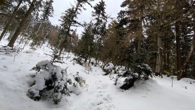
I like to hike to Dreitannenriegel from here, but the path isn't recommended for untrained individuals or solo hikers. It's quite strenuous, but a lot of fun to visit our local mountain. Temperature differences between the parking lot and the top can be 8-10 degrees. The pictures are from the same (!!!) day in April.
Freizeit Bikerin
14. December 2020
Great parking lot in a convenient location for many different hiking tours. Plenty of spots, but of course packed when the weather is nice.
Torsten Kühnlein
2. April 2024
Nice hiking parking lot, we stayed here with our camper for a night. Very quiet and perfect for a lovely hike or bike tour.
Sebastian Weise
17. July 2020
Small but sufficient and well-located parking lot as a starting point for hikes. Space for about 30 cars. It's about 1.9 km to Dreitannenriegel from here, steep uphill, but worth it.
Rupert Keppeler
12. July 2026
Ideally located for hiking and MTB tours.